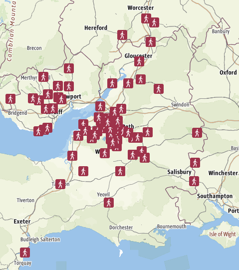
Since we moved to Bristol in 2009, I have done hundreds of linear walks through the countryside around Bristol, without driving. Since 2023 I have been gradually recording them and putting them on this website, and also Railwalks.co.uk which is a national website. Some start from the city centre on foot and return by train or bus. Most use trains. Some use buses. I am recording them as gpx files and uploading them to Outdooractive, where you can view them on a map. Follow the links on the pages below.
This page is one of many listed on www.railwalks.co.uk
*Please note: when following a route walked by someone else, you must ensure your own safety. I try to avoid busy roads, but sometimes they are unavoidable. I also try to stay on legal rights of way, but I may sometimes deviate because the path was blocked or unclear, or I was trying to avoid a hazard such as bulls or cows with calves!